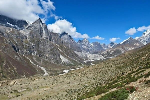
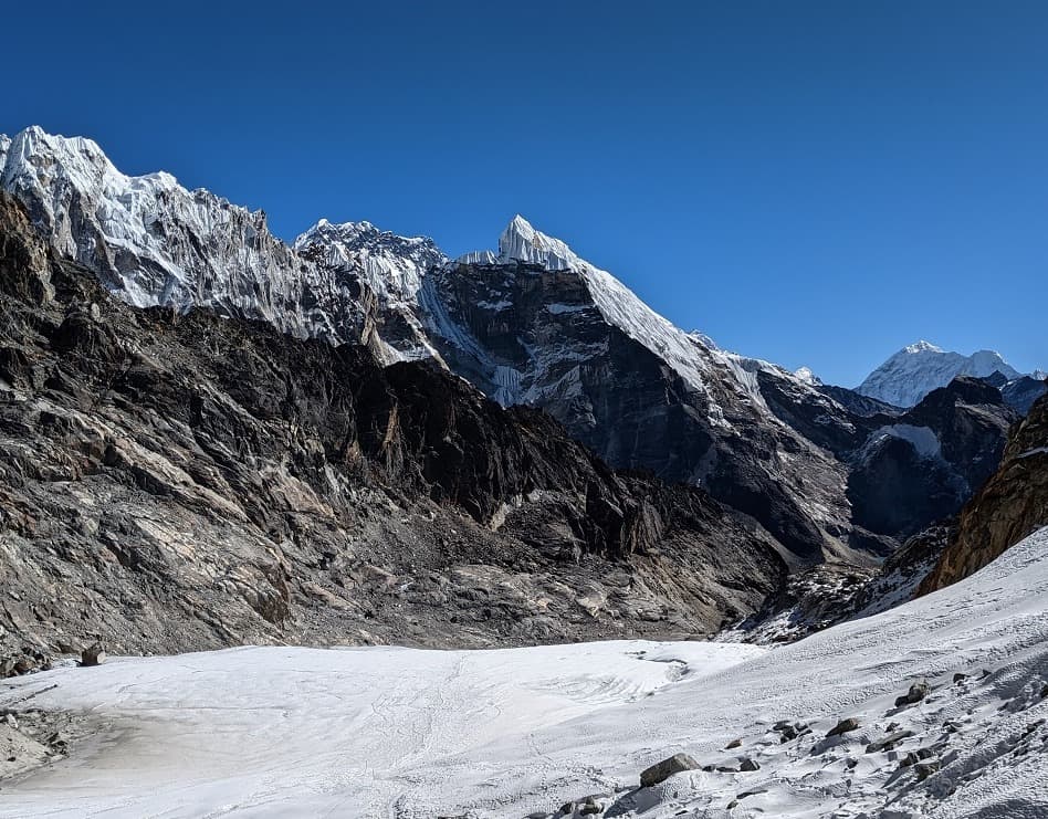
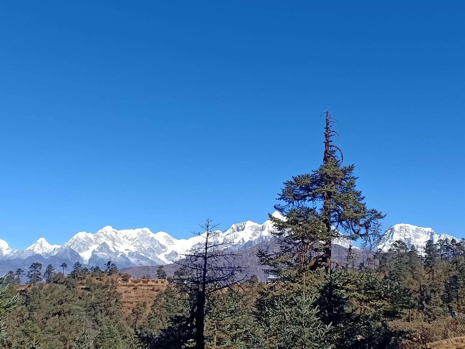
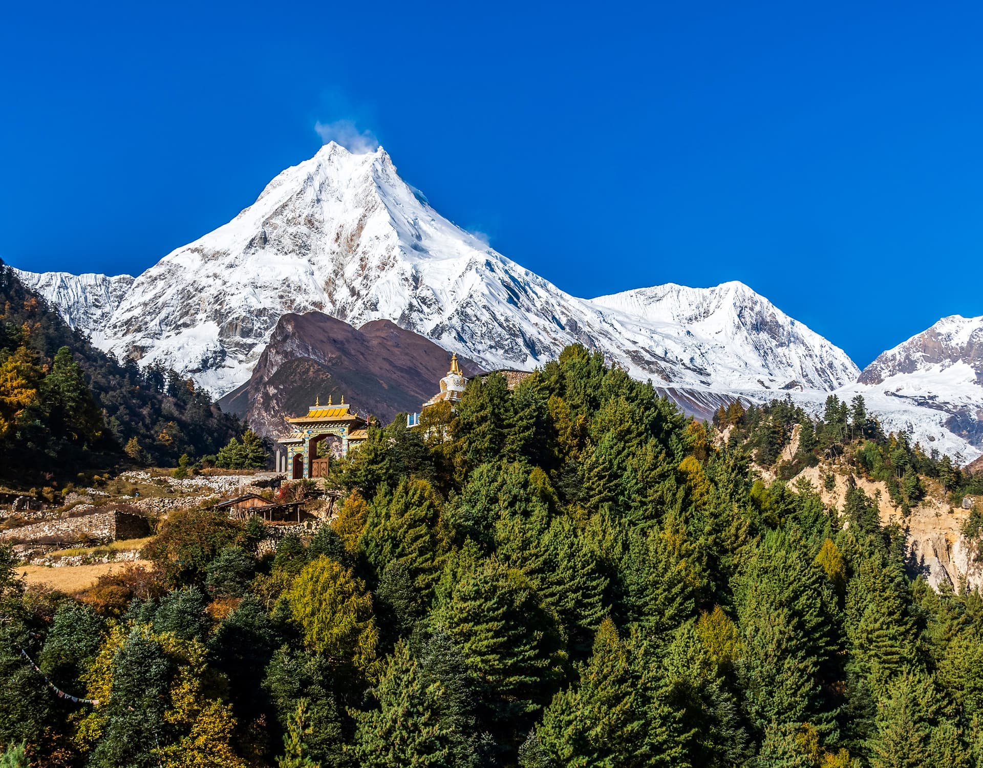
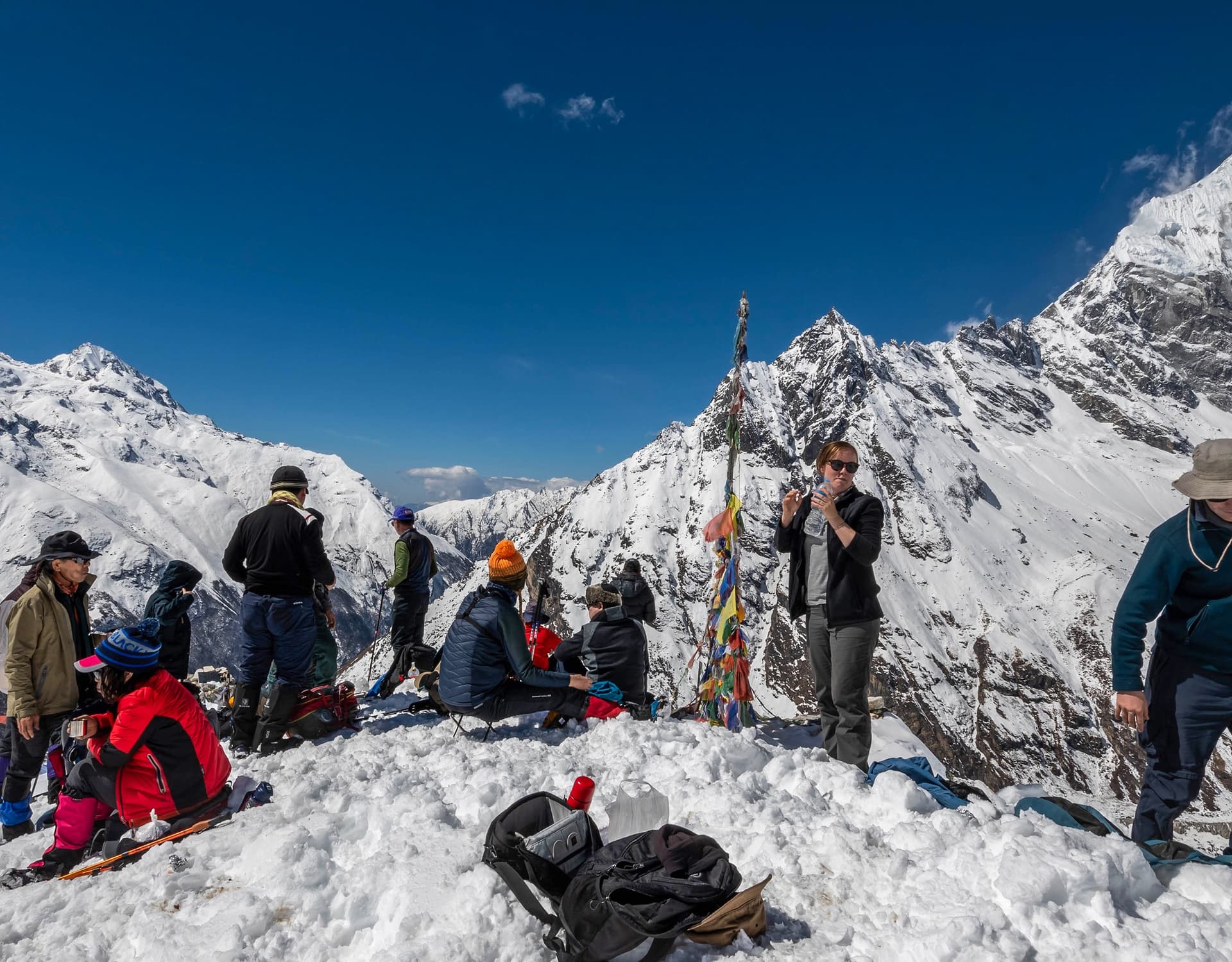
Not only does the Jiri Everest Base Camp Trek contain Mt. Everest, but it also comprises some other equally magnificent eight-thousand-meter peaks, including Lhotse, Cho Oyu, and Makalu. Most certainly, it is the most famous place in all the Himalayas for mountaineering and trekking, and it is characterised by countless silver peaks, vast glaciers, blue lakes, charming mountain villages, and two large national parks. It is also characterised by diversity in flora, fauna, landscapes, and local cultures, offering tourists numerous trekking opportunities. From an Everest High Pass trek to an easy Everest panorama trek, it covers them all. Yet, there is no denying that the best and most classic one is the Jiri Everest Base Camp Trek.
DestinationNepal
Duration22 days
GradeModerate to Adventurous
ActivitiesTrekking
AccommodationTea-House and Lodge
Max. Elevation5555m.
Group SizeMin. 1 Pax
Vehicleprivate vehicles
MealsBreakfast, Lunch, and Dinner during The Trek
Overview
The Jiri Everest Base Camp Trek, located in Eastern Nepal, is home not only to Mt. Everest but also to other impressive eight-thousand-meter peaks such as Lhotse, Cho Oyu, and Makalu. Inarguably the most popular area in the entire Himalayas for mountaineering and trekking alike, the region boasts innumerable silver peaks, colossal glaciers, and cobalt lakes, picturesque alpine hamlets, and two large national parks. The area is diverse in terms of vegetation, topography, and culture, offering trekkers an array of itineraries to choose from. Be it a strenuous and adventurous Everest High Pass trek or a more laid-back Everest panorama trek, there is something for everyone. However, the most timeless, classic, and wholesome trek is the Jiri Everest Base Camp Trek.
The Jiri Everest Base Camp Trek route is a historic trail to the top of the world, first successfully led by Sir Edmund Hillary and Tenzing Norgay Sherpa in 1953 AD, marking the first-ever successful expedition of Mount Everest. The trek trail passes through the beautiful Jiri Valley, also known as the Switzerland of Nepal.
Trip Highlights
Trekking to the world’s highest, Mt. Jiri, and the Everest Base Camp Trek.
Amazing scenery throughout the trek, with awesome panoramas.
Visiting traditional villages enriched with old culture and religion.
Home of the Highlander, the Sherpa of the Solu and Khumbu region of Everest.
Into the tranquil woodland of beautiful rhododendrons, pines, and birch trees.
The 23-day Jiri Everest Base Camp trek passes through iconic high hills and sub-alpine settlements of Dolakha, Ramechap, and Solukhumbu, enabling trekkers to be in close proximity to the towering mountains and to experience the rich lifestyle and culture of the local villages.
The Trek itinerary includes some of the famous viewpoints and settlements, such as Namche Bazaar, the Monasteries of Tengboche and Dingboche, and viewpoints like Gorakshep and Kala Patthar. Throughout the route from Namche Bazaar to the Everest base camp, we will have excellent views of Mt. Everest and other equally mesmerising peaks above 8,000m like Mt. Manaslu (8,163m), Mt. Makalu (8,485m), Mt. Cho Oyu (8,188m), and Mt. Kanchenjunga (8,586m).
In addition to being a time-honoured trail to Everest that allows you to savour all its natural beauty, the Jiri Everest Base Camp Trek is also a perfect route to witness the unique, rich culture of the Sherpa people. As the elevation increases, we will be able to trek through several picturesque Sherpa villages, showcasing beautiful alpine settlements that have long adapted to mountain life. Thus, this trek is not only an adventure-packed nature trek but also a rare cultural trek that offers experiences of the unique lifestyle and traditions of the celebrated Sherpa people.
The Jiri Everest Base Camp Trek itinerary can be customised to your preferences. New places and activities can be added to your routine to enrich your trekking experience. For instance, if you want to stretch the time of your stay in the Himalayas, you can incorporate the Gokyo Chola pass to the Everest base camp Trek or the Everest High Passes Trek into the itinerary. The most suitable times to undertake the trek are autumn (October and November) and spring (April and May). The months have been selected based on visibility and climate.
Itinerary of Everest Base camp trek from Jiri - 22 days
On reaching Kathmandu via respective airlines, our TH staff will be received with courtesy transfer to hotels in the centre of Kathmandu around the Thamel area, an interesting area with many shops, stores, and excellent world-class restaurants, with time for a short walk. To buy necessary items for the trip, our guide will inform and brief us at the hotel regarding trekking and other important things.
Max. Elevation:1350 M
A long day's journey, so starting early morning from Kathmandu for the drive to Jiri, this interesting scenic drive passes through interesting towns and villages through the Himalayan foothills, through towns of Dhulikhel, Chrikot, and then to Jiri for an overnight stop. Jiri is one of the nice towns often called the Switzerland of Nepal Himalaya.
Max. Elevation:1900 M
Duration:5.47 Hours
Distance:180 Km
After a good stop in Jiri, starting the first day walk, leaving behind Jiri and the motorable road behind, the walk continues with a climb to a hilltop with fabulous views of the surrounding scenery with Jiri town below, and then descending towards a river valley to Shivalaya village for an overnight stop, a fair-sized village with some lodges for travellers.
Max. Elevation:1770 M
Duration:6 Hours
Distance:182 Km
From Shivalaya to Bhandar a nice and moderate trek, starting the morning walk with an hour-slow climb to the small village of Sangbadanda, then on the winding gradual path passing many farm villages and forested area, reaching a stream with a climb through the cool shade of rhododendron pine, oaks tree lines, after few hours of good walk reaching Deurali pass top at 2, 715 meters, after lunch at Deurali a long downhill for about two hours to reach Bhandar village for overnight stop, passing into interesting large Stupa enclosed inside a wall and then through villages and farm-fields till Bhandar or Chyangma village is reached, this village with mix tribes of people Tamangs, Newars, but predominantly Sherpa people.
Max. Elevation:2195 M
Duration:5 hours
The morning walk continues downhill into the cool shade of forest and farm terraces, passing several farm villages, to reach Kenja village at 1,634m. Kenja is a nice, moderate-sized village, situated in a warm valley just beneath the high hills of Lamjura and Pikey danda, offering views of Numbur peaks. After Kenja, there are steep uphill climbs all the way to an overnight stop at Sete village. From here on, the temperature cools.
Max. Elevation:2575 M
Duration:6 hours
Starting the trek with a cool morning then heading towards Lamjuta-la pass with a slow steep climb into the dense forest of rhododendrons, pines, and oaks trees then through many small farmlands and hamlets, after a few hours of steady uphill walk reaching the top of a Lamjura pass with a big stupa and lodges, from here a long descend through forest of firs and rhododendron trees to Sherpa village at Toctoc, from here continue walk on the gradual winding path to Junbesi, from the ridge looking at Junbesi way below, then with a final descend to Junbesi, a nice large village inhabited mostly by Sherpa people, this village with a nice interesting monastery and a high school sponsored by Sir Edmund Hillary Trust.
Max. Elevation:3530 M
Duration:6 to 7 hours
Distance:11 to 13 KM
After a wonderful time at Junbesi, a morning walk leads on the winding smooth path with the first glimpse of Mt. Everest with other snow-capped mountains, after a break here heads down to the river, after crossing the bridge with a short climb to Ringmo village, stop here for lunch as time permits after leaving Ringmo, an hour of gradual slow climb into a forest of pines and rhododendron trees then reaching Trakshindu pass at 3,070m marked with mani and shortens with grand views of Numbur, Kusum Kangguru, Thamersarkhu, and Kantega peaks. From here, a long downhill walk to Nunthala through Takshindo village, with an old monastery, continues descending through the forest, then reaches farmland on the outskirts of the village. After reaching the bottom of Takshindo hill, a short walk to Nuntahla, also known as Manidingma, a large mid-hill village of the Rai tribe and the Sherpa people.
Max. Elevation:2190 M
Duration:6 Hours
The air gets much cooler as the walk leads closer to the Khumbu area after being in the Solu region, the morning walk starts with a downhill through the forest area to the bridge over the Dudh Kosi River, from here crosses the raging Dudh Kosi River, then leading on the slow winding uphill trail to Jubing village, around this area are warm with citric trees and plants, after Jubing following an uphill path to Kharikhola 2,200m, a large village with Sherpa and Magar inhabitants, after a break here heading towards next hill, after crossing a river tributary of Kharikhola, then it leads to a steep climb for an hour to our overnight stop at Bupsa a small village, located on the ridge overlooking fabulous views of rolling hills and valleys.
Max. Elevation:2550 M
Duration:6 hours
From Bupsa, a slow, steady walk leads into the Khumbu region, where the air gets much cooler. The morning walk starts with an uphill climb through a mixed alpine forest, where small wildlife, like pheasants, is abundant. The walk continues climbing over Kharte Dande, passing at 3,880m high above the Dudh Kosi river. The morning walk reaches Puiyan village at 2,800m, a nice place in the middle of a forest.
After lunch, we walk along the winding trail with views of Lukla town and its airstrip from the ridge top. Our route descends to Surkhe, where we overnight. Surkhe is located just below Lukla.
Max. Elevation:2295 M
Duration:6 Hours
After Surkhe, head towards the main trekking trail, passing Muse and Chowrikharka farm village near Lukla. Being in the isolated area for many days, from here onwards on the famous route to Everest Base Camp where the trail from Lukla joins at a small Choplung village, walking is easier and pleasant on the gradual path to Phakding with a few small ups in between, reaching at Tarhe Khola, with a wonderful view of Kusum-Kangru 6,369m, after crossing the bridge with a short climb reaches to Ghat village, from here onwards an hour of pleasant walk to Phakding village for overnight stop by the bank of Dudh-Kosi River.
Max. Elevation:2630 m
Duration:5 Hours
The morning walk starts with an easy walk with a few ups following the river Dudh Kosi most of the way, crossing the same river by suspension bridge reaching Monjo village a nice village with lodges catering the trekkers for many years, a view of Thermasharkhu peak and Khumbi-la mountain the patron god of Khumbu area, Monjo is the entrance of Sagarmatha National Park at the park entrance a rest after getting the permits to travel this area requires Park permits with fees. As well, TIMS (Trekking Information Management System) continues walking after a brief rest here, crossing the bridge over the Dudh Kosi and heading to Jorsalle village for lunch. This is the only village for 2-3 hours till Namche is reached. From here walk on the river bed for a while and then after crossing the last bridge over Imjatse River (which joins Dudh Kosi) an uphill walk for a few hours through a beautiful alpine forest lined with rhododendrons, pines, and fir trees with the awesome mountain scenery of Kwangde, Kusum Kanguru if the day is a clear view of Mt. Everest and Lhotse also, after a hard climb of few hours reaching famous Namche Bazaar the Sherpa capital of Khumbu region with many houses with lodges, hotels, pubs, restaurant with fresh bakery and cyber café, health post, post office, and banks.
Max. Elevation:3440 M
Duration:5 hours
Distance:8.5 Km
It is important and necessary to have a rest day or 2 nights at this altitude to safeguard from AMS (Acute Mountain Sickness), where drinking plenty of fluids helps, but not alcoholic drinks, which dehydrate you. In Namche optional walks around the neighboring area up to Everest View Hotel (believed as world's highest hotel at 3,880 meters) a 2-3 hour hike with promising mountain views of Mt. Everest and the magnificent Ama Dablam peak, or a walk to the top of Namche hill with an aerial view of Namche with Mt. Everest, Lhotse, Tawache, Tarmasarku, Kwangde, and Ama Dablam peaks and visit the interesting museum with full of information of this Khumbu area, afternoon at leisure to browse around the bazaar with nice stores, this place is flooded with locals and trekkers on Saturday big market.
Max. Elevation:3880 M
Duration:5 hours
Distance:5.4 KM
Morning with a short climb to the ridge above Namche and then on the pleasant walk for the first half of the day with views after views of mountains and surrounding beautiful landscapes, and into nice woodland and then on the downhill slope for an hour to reach lunch break at Phungi-tenga, located in a gorge by the river Imjatse and in the middle of alpine woodland.After a refreshing moment, starting with an uphill for 2 hours through nice tree lines of rhododendrons and pines with beautiful views of snow-clad peaks, and finally reaching the famed Tengboche Monastery (Gomba) for an overnight stop.
This beautiful scenic spot offers tremendous views of peaks that encircle this place with Mt. Everest, Lhotse, Nuptse, and towering Mt. Ama Dablam, Kangtenga, Thermasharkhu, and Kwangde peaks, afternoon visit this interesting monastery with Lama and monks chanting prayer at the main hall statue of Sakyamuni Buddha and with thanka paintings around the wall and ceiling and then visit the small museum.
Max. Elevation:3867 M
Duration:5 Hours
Distance:10.5 KM
After an interesting, impressive time here, a morning walk leads to a descent through a nice, serene forest, passing a few prayer walls, and then crossing a bridge over the raging Imjatse River. After the bridge, a slow uphill walk with a few steep climbs and descents to Pangboche village (the last permanent village on the route to Everest base camp)
From here a short steep climb to Shomare a small settlement popular stop for lunch on the route trekking higher, after lunch a gradual uphill climb on the windy exposed terrain and crossing the same river and with a climb for an hour reaching our overnight stop at Dingboche a nice place located at the start of Imjatse valley beneath the towering Ama Dablam North Face and Mt. Lhotse with nice views of Island / Imjatse peak towards east.
Max. Elevation:4410 M
Duration:5 Hours
Distance:11.5 Km
From Dingboche with good night's rest, the morning walk leads to a short climb over a hill festooned with prayer flags and Buddhist payer monuments, overlooking superb views of Imjatse Valley, Ama Dablam North Face, Island / Imjatse Peak, and world’s 5th highest Mt. Makalu towards east the peaks of Twache and Cholatse looks closer from this spot, from here on the gentle uphill path leading to a small place at Thukla for a lunch stop, where the trail from Gokyo via Tshola and Pheriche meets. As well, the Khumbu glacier melts into the torrential river. After a nice break, there is a steep climb for an hour to the cairn of Thulga Pass top, where many tombs and memorials are placed for the unfortunate mountaineers. From here, a good walk for another hour brings you to Lobuche for an overnight stop, with more than good lodges around beneath the Lobuche East and West Peaks.
Max. Elevation:4900 M
Duration:5 Hours
Distance:8 km
Today, this awesome journey leads to our goal and highlight of this great trip, a morning walk on the gentle slope for a few hours, passing near the meteorological stations of glass pyramids managed by Nepal and Italian scientists on the glacier of this area. From here walk leads over the rocky moraine and ice and below Khumbu glacier with views of Everest, Nuptse, and Mt. Pumori. After crossing the moraine area, reach Gorakshep, located on the route to Everest base camp and Kalapathar climb, with Mt. Pumori soaring above this flat valley. After a good rest, continue walking for 2-3 hours to Everest Base Camp through glacier and moraine sections. on reaching Everest Base Camp, grand views of Nuptse, Lho-la, Changtse in Tibet, and the top of
Everest with its notorious Khumbu ice falls and glaciers at a near distance from the base camp. This desolate but tremendous spot feels out of this world. During the high expedition season around April and May, this place is flooded with different groups of expeditions. After an overwhelming moment, retrace the walk back to Gorakshep for an overnight stop after feeling high and at ease after reaching the goal of this trip.
Max. Elevation:5164 M
Duration:2 to 3 Hours
Distance:4.5 KM
Yet, another highlight of this trip to be accomplished climb to the top of Kalapathar the highest point of this adventure at 5,545 meters offering a stupendous panorama of surrounding mountains with Mt. Pumori high above the rocky top of Kalapathar and a view of Mt. Everest at a mere distance, the climb leads for two hours on the steep path, on reaching enjoy the glamorous views on the highest spot of this adventure, from here reach Gorakshep for breakfast and continue descend towards Lobuche and to Thukla and then on the new trail to Pheriche, walk leads downhill for an hour and into the windy valley floor walking for an hour to Pheriche located on a wide valley with windy afternoon with views of Cholatse, Tawache and Ama Dablam, this place with HRA station (Himalayan Rescue Association).
Max. Elevation:5644 M
Duration:2 to 4 Hours
Distance:1.5 KM
From Pheriche, a nice walk to the river and then a short climb with a downhill towards Somare and Pangboche village on the same trail to Tengboche for an overnight stop in these beautiful surroundings.
Max. Elevation:3867 m
Duration:4 Hours
Distance:8.5 Km
After a wonderful time at Tengboche Monastery, with the sound of the monks and lamas chanting Morning Prayer, we headed downhill to cross the Imjatse River, then climbed for an hour, and gradually retraced our journey back to Namche Bazaar and Monjo. After a rest and lunch stop, afternoon downhill to Monjo and back to Dudh Kosi Valley, crossing the same river a few times, and back at the national park entrance/exit gate, and then to Monjo for the overnight stop.
Max. Elevation:2880 m
Duration:6 Hours
Distance:8.3 KM
Today is the last day of trekking: a pleasant walk retracing the same trail, passing through the villages of Phakding, Benkar, Ghat, and Choplung. From here, the last climb of this trip is for an hour to Lukla. On reaching Lukla in the afternoon or at lunchtime, there will be time for a stroll around Lukla bazaar.
Max. Elevation:2846 M
Duration:6 Hours
Distance:9.5 Km
Morning transfer to Tenzing-Hillary Airport at Lukla, as per the flight time board. The small plane, a Dornier or Twin Otter, for a short, scenic 35-minute flight brings you to Kathmandu, and then transfers you to your respective hotels, with the afternoon free for leisure and souvenir shopping.
Max. Elevation:1350 M
Duration:30 to 40 Mins
Distance:138 KM
Last day in Nepal, after a most memorable and overwhelming time in the high Himalayas with the great service of Team Himalaya guides and staff, transfer to Kathmandu International Airport terminal for your flight to your respective countries.
Max. Elevation:1350 M
If the provided schedule isn't suitable for you, we can create personalized travel arrangements.
**Discounts are determined exclusively by the size of your group. We do not add additional members to your group.
July 2026
Su
Mo
Tu
We
Th
Fr
Sa
28
29
30
1
2
3
4
5
6
7
8
9
10
11
12
13
14
15
16
17
18
19
20
21
22
23
24
25
26
27
28
29
30
31
1
Sold out dates
US $0US $0 per person (based on 1 people)
Cost Includes
Pickups and drops from hotels and airports.
Tourist-star hotel in Kathmandu and tea houses \ lodges during the trek.
Breakfast in Kathmandu.
Kathmandu -Jiri by Public Transport as per the group size.
All meals during the trek. (BREAKFAST, LUNCH and DINNER)
All necessary paperwork and National Park permits \TIMS.
Domestic flights (Lukla –Kathmandu) and airport departure taxes (allowed to carry a maximum of 15 Kg Luggage) altogether including both backpack and day bag.
All our government taxes. vat, tourist service charges.
An experienced, knowledgeable, helpful, friendly, and English-speaking Trekking guide. Food, drinks. accommodation insurance, salary, pieces of equipment, transportation, and medicine all stuff.
Down jacket and sleeping bag by team Himalaya (which need to be returned after the trek)
Group medical supplies (first aid kit will be available).
Trip achievement appreciation certificate.
Fresh fruit is seasonal during the trip.
Jiri Everest base camp trek map.
Official expense.
Travel and rescue arrangement .
Cost Excludes
Lunch and dinner in Kathmandu.
Personal expenses (phone calls, laundry, bar bills, battery recharge, extra porter, bottle or boiled water, shower, etc).
International airfare to and from Kathmandu.
Kathmandu Valley Sightseeing tour entrance fees.
Travel and rescue insurance.
Excess baggage charge.
Extra night accommodation in Kathmandu because of early, late, and early return from the mountain (due to any reason) than scheduled.
Tips for trekking staff and drivers (tipping is expected).
Route Map
Loading map...
Know Before you Go
Guide to the Jiri to Everest Base Camp Trek
The journey from Jiri to Everest Base Camp offers a unique adventure along the path first used by early Everest climbers. Trekkers can enjoy breathtaking landscapes and immerse themselves in local culture. This guide provides the necessary information to plan and prepare for the trek.
Choosing the Best Time to Go
Spring (March–May) and autumn (September–November) are the best times for this trek, offering stable weather and clear skies. In spring, the trails are filled with colorful rhododendron blooms, while autumn brings crisp air and spectacular views of mountains such as Everest, Lhotse, and Ama Dablam.
Trekking is also possible during the winter (December to February), but you must be prepared for extremely cold temperatures and snow-covered trails at higher altitudes. The monsoon season (June to August) brings significant rainfall, making trails muddy and slippery, though the landscape becomes lush and green.
Tip: If your priority is seeing the trail come to life with colorful scenery for photography, choose spring. For the clearest and most expansive mountain views, autumn is the better option.
Assessing the Difficulty
This trek is tougher than the usual route from Lukla because it takes longer, about 21 to 22 days. The first week involves a lot of uphill and downhill walking over passes such as Lamjura La and Trakshindu La. After joining the main Everest trail, the main challenge is the high altitude, with the path reaching over 5,000 meters at Everest Base Camp and Kala Patthar.
Tip: Prepare for the trek by improving your stamina through regular cardiovascular workouts, such as running, swimming, or cycling. Include exercises that simulate trekking conditions, such as uphill walking, stair climbing, or hiking with a loaded backpack.
Acclimatization and Altitude Management
Beginning the trek in Jiri at 1,900 meters helps your body adjust slowly to higher altitudes. The plan includes important rest days in places like Namche Bazaar and Dingboche, which help you get used to the thinner air. Always pay attention to how you feel and watch for signs of altitude sickness. Always walk at a slow and deliberate pace, and drink plenty of water.
Tip: If you experience symptoms such as a headache, nausea, or dizziness, do not continue climbing. Move to a lower altitude and take time to rest before deciding if you can continue.
Accommodation and Dining
Lodging is available in teahouses and small lodges along the route. Facilities on the Jiri section of the trail are simple, typically offering twin beds and shared bathrooms. As you approach the more popular Everest region, services improve, with many lodges offering amenities like hot showers, bakeries, charging stations, and basic internet access.
The cuisine is hearty and diverse. You will find classic Nepali dishes, such as dal bhat, as well as regional specialties like Tibetan thukpa (noodle soup) and momos. Meals are filling and varied. You can try Nepali favorites like dal bhat, along with Tibetan dishes such as thukpa (noodle soup) and momos (dumplings). In bigger villages, you’ll also find Western foods like pasta, pancakes, pizza, and burgers. Keep in mind that food becomes more expensive as you move higher, since supplies are harder to obtain, especially in more remote areas.
Tip: It’s a good idea to pack your own high-energy snacks, such as nuts, chocolate, and energy bars, which are perfect for long trekking days and may not be available in more remote areas.
Required Permits
Three permits are necessary for this trek:
1. Sagarmatha National Park Entry Permit 2. Khumbu Pasang Lhamu Rural Municipality Entry Permit 3. Trekkers Information Management System (TIMS) Card
These permits are checked at several checkpoints along the route. All permits will be arranged and managed by our company either in Kathmandu before the trek begins or along the trail at official checkpoints.
Tip: To speed up the process, bring extra passport photos and photocopies of your passport. Be sure to keep your permits in a safe place, as you will need to show them multiple times throughout the journey.
Packing Essentials and Transport
It’s important to pack carefully for this long trek. Ensure you bring gear suitable for various weather conditions and trail types.
Essential Gear: * Trekking Boots: Comfortable, broken-in boots are your most important item. * Layered Clothing: A thermal, a fleece, and a down jacket are perfect for managing temperature changes. * Outerwear: Waterproof and windproof jacket and trousers. * Sleeping Bag: Use a high-quality sleeping bag designed for temperatures as low as -15°C. * Head & Hands: Warm gloves, a wool hat, and a scarf or buff. * Sun Protection: UV-protective sunglasses and high-SPF sunscreen. * Hydration: Reusable water bottles with purification tablets or a filter. * Support: Trekking poles for stability on challenging terrain. * First Aid: A personal first aid kit with pain relief and altitude sickness medication. * Lighting: A headlamp with extra batteries. * Power: A portable power bank or solar charger for electronics.
Most people hire porters to carry most of their luggage, usually about 10 to 15 kg per person. Try to pack only what you really need.
The trek begins with a scenic 7 to 8-hour drive from Kathmandu to Jiri. Most trekkers return to Kathmandu by taking a short flight from Lukla. Please note that these flights may be delayed or canceled due to changing weather conditions in the mountains.
Tip: It’s wise to add one or two extra days to your schedule to accommodate possible flight delays when traveling to or from Lukla. If your flight is from Manthali, it’s a good idea to travel there the night before to avoid an early-morning road transfer.
Cultural Immersion and Sustainable Practices
The Jiri approach enables trekkers to witness traditional Nepalese village life before reaching the busy Khumbu region. Starting from Jiri, you can experience this firsthand. Along the way, you’ll meet people from groups like the Tamang, Rai, and Sherpa. In the Everest region, you can visit ancient monasteries such as Tengboche and witness Buddhist ceremonies. Structures such as mani walls and stupas. When in private quarters or a temple, do not direct your feet towards any image of a Buddha.
Hiking this trek here means following eco-friendly practices. The route passes through fragile environments with little waste management. Try to avoid single-use plastics and follow the 'leave no trace' rule. Supporting local businesses and respecting local customs helps build good relationships with the people you meet.
Tip: Carry a small reusable bag for trash and consider offering donations to local monasteries or schools, if possible. This is a meaningful way to support the community and reduce environmental impact.
Insurance
Having reliable travel insurance is essential for this trek. Our company, like many others, requires trekkers to be insured, even though it is not legally compulsory. Insurance ensures you are protected from the high costs of medical care, evacuation, or other emergencies in remote mountain regions.
Your policy must include:
High-Altitude Coverage: Ensure your policy includes coverage for trekking up to a minimum altitude of 6,000 meters. Most basic plans have limited altitudes that will not ensure you on this trek.
Emergency Helicopter Evacuation: This is probably the most crucial aspect. If you experience severe altitude sickness or face a serious injury, a helicopter may be the only means of accessing medical care in a timely manner. A helicopter rescue can cost tens of thousands of dollars without insurance.
Medical: Make sure your insurance covers medical treatment, hospital stays, and medication in Nepal.
Trip Cancellation/Interruption: This coverage will protect your investment by reimbursing the non-refundable cost of your trip if you have to cancel or interrupt it due to unforeseen circumstances.
Tip: Check the fine print of each policy to ensure that your intended trekking altitude and helicopter rescue (if required) are covered. It’s a good idea to keep this kind of insurance in place long before you go away.
Electricity and Communication
In most villages on the Jiri part of the trek, you’ll find electricity, but it may only be available for a few hours each day. In the Everest region, electricity is more reliable, but lodges often charge extra for charging devices. Higher up, many places use solar panels.
Mobile networks like NTC and Ncell operate in some lower areas, but the signal strength decreases as you climb higher. After Namche Bazaar, many lodges offer Wi-Fi for a small fee, but the connection is often slow and not always reliable.
Tip: Carry a fully charged power bank or a small solar charger and avoid relying solely on mobile data. Inform your family that you may be out of contact for several days in remote sections.
Drinking Water
It’s very important to stay hydrated while trekking at high altitudes. You can buy bottled water at most teahouses, but it’s better for the environment and your budget to use a refillable bottle and treat the water yourself. Always purify water from taps or streams by using tablets, a filter, or boiling it.
Tip: To avoid single-use plastics and save money, bring a reusable water bottle along with water purification tablets or a compact water filter for safe drinking water
We had a very successful EBC trek in October 2024 because of Team Himalaya! Our guide, Raj, was very knowledgeable in all things Everest. He set us up in the best lodges where we had great service all along. He provided us with a superb porter, who also went above and beyond in taking care of us. Raj was very patient with us and was always looking out for our best interests. We would highly recommend Team Himalaya for any trek!
AAlec S1st Apr, 2024
Everest Base Camp Team Himalaya March 2024
We have just returned from a 14 day, 11 day hike with Raj and Durga from Team Himalaya to Everest Base Camp. From the minute we landed to our departure we were properly looked after and cared for by Team Himalaya. The trek to and from Everest Base Camp was wonderful, our guides and porters really looked after us and were incredibly knowledgeable. In Nepal things can go wrong especially with flights to and from Lukla but Team responded magnificently and found alternative solutions. If this is on your bucket list as ours and you are looking for a company to organise this with I would 100% recommend Raj.
JJourney379926937861st Apr, 2024
Reaching Everest Base Camp with TEAM HIMALAYA
If you are looking for an adventure of a lifetime, don’t hesitate! Choose TEAM HIMALAYA for your Everest Base Camp trek! We completed the EBC trek early November 2023 . My husband and I chose to do a private trek with Team Himalaya. Everything went smoothly with our guide Raj. His team and organization is outstanding! We could not have done it without him. Raj took care of everything throughout the trek and made sure we were well at all times, even providing us fresh fruits every night after dinner! We felt safe at all times , his experience and knowledge of the Himalayas helped us achieve our goal in reaching the EBC! His professionalism went beyond our expectations from our first contact with him for information until the very end. We will forever remember this expedition and gained a friend in our guide Raj!
eevanhH6577DL13th May, 2023
Incredible Experience by evan
It was an incredible experience being surrounded by the towering Annapurna Himalayas. This memorable trek through Nepal offered the best scenic views and stunning landscapes. Despite being surprised at how quickly the trek ended, the daily walks were filled with dramatic views that left a lasting impression.
I highly recommend this adventure, as it is one of the best base camp treks in the Himalayas with minimal risk of altitude sickness. Although there were steep ups and downs that were tiring on some days, the breathtaking views made it all worth it. This was easily the most exciting trek I have ever experienced.
I want to thank Team Himalayas and Raj for providing exceptional service with their expert guide and staff.
Frequently Asked Questions About the Everest Base camp trek from Jiri
How long does the Jiri to Everest Base Camp Trek take?
The trek usually takes around 21–22 days, depending on your pace and acclimatization days.
How is this trek different from the standard Lukla to EBC route?
The Jiri route is longer and more challenging. It follows the traditional trail used by early Everest climbers, passing through rural villages before joining the main Lukla trail.
What is the best season to do the trek?
Spring (March–May) and autumn (September–November) are the best seasons, offering stable weather and clear views.
Do I need prior trekking experience?
While not mandatory, some trekking experience is very helpful. The trek is physically demanding and requires good fitness.
How fit should I be for this trek?
You should be able to walk 6-7 hours a day with a backpack. Regular cardio and endurance training before the trek is strongly recommended.
What is the maximum altitude reached?
The highest point is Kala Patthar at 5,545 meters, which offers the best close-up view of Mount Everest.
Is altitude sickness a big concern?
Yes, altitude sickness is possible. The trek includes rest days in Namche Bazaar and Dingboche to help acclimatize.
What kind of accommodation is available?
Teahouses and small lodges are available along the route. Facilities range from very simple in the Jiri section to more comfortable in the Khumbu region.
What types of food are served?
Meals include Nepali staples like dal bhat, Sherpa dishes such as thukpa and momos, and some Western foods like pasta, Pizza, pancakes, and eggs in bigger villages.
Are permits required?
Yes. Three permits are required: Sagarmatha National Park Entry Permit, Khumbu Pasang Lhamu Rural Municipality Permit, and TIMS Card. Our company arranges all these for trekkers.
Is a guide or porter necessary?
Hiring a guide and porter is highly recommended for safety, cultural insight, and reducing the physical strain of carrying heavy bags.
What should I pack?
Essential items include broken-in trekking boots, warm layered clothing, a down jacket, a sleeping bag, waterproof gear, trekking poles, and a personal first aid kit.
How do I get to the starting point in Jiri?
The trek starts with a 7–8 hour drive from Kathmandu to Jiri, through scenic hills and rivers.
How do I return after finishing the trek?
Most trekkers take a short flight from Lukla back to Kathmandu. Keep extra days in your itinerary as flights are often delayed.
Is communication available during the trek?
Phone signals work in some lower areas, while Wi-Fi is available in many lodges after Namche. However, the connection is slow and unreliable at higher altitudes.
Is electricity available?
Yes, but it may be limited, and lodges often charge extra for charging devices. Solar power is common in higher villages.
Do I need travel insurance?
Yes, comprehensive travel insurance with coverage for trekking up to 6,000m and emergency helicopter evacuation is mandatory.
Is drinking water safe?
Bottled water is available, but we encourage using refillable bottles with purification tablets, filters, or boiling water to reduce plastic waste.
What cultural experiences can I expect?
You’ll encounter Tamang, Rai, and Sherpa communities, visit monasteries like Tengboche, and observe Buddhist rituals and traditions.
Why should I choose the Jiri route over Lukla?
The Jiri route offers a gradual acclimatization, richer cultural experiences, and fewer crowds. It’s perfect for trekkers seeking a traditional and rewarding Everest adventure.