Humla Kailash trek is considered to be the finest trekking spot. The trek to Mount Kailash or Mansarovar from Humla has been officially open for trekkers since 1993. Since then, this trek has gained popularity as an excursion to the Mt. Kailash for pilgrimage purposes. Humla Kailash trek is significant because of its spiritual and cultural aspects, as it is a pilgrimage in one of the most distant areas of Nepal that leads to Tibet. Humla is one of the most distant districts, but it is known for its unique cultural and scenic beauties.
DestinationTibet
Duration9 days
GradeModerate to Adventurous
ActivitiesTrekking
AccommodationTea-House and Lodge
Max. Elevation5630m.
Vehicleprivate vehicles
MealsBreakfast, Lunch, and Dinner during The Trek
Overview
The Humla Kailash Trek is the best trekking destination. Trekking to Mt. Kailash or Mansarovar via Humla was officially opened to trekkers in 1993. Since then, this route has been popular for pilgrimage to Mt. Kailash. Humla Kailash trekking is valued for its religious and cultural significance, offering a pilgrimage through one of Nepal's remotest regions to Tibet. Humla is a remote district; however, it is celebrated for its cultural and natural attractions. Ethnic groups like the Bhotias, inhabiting the border between Nepal and Tibet, will offer us a harmonious blend of cross-cultural endurance and understanding. Much of their trade and culture is connected to Tibet rather than to Nepal. The plateaus and arid landscapes in this remote region will certainly please one tremendously.
The Humla region is a less-exposed, less-crowded trekking destination in Nepal. We hardly see concrete roads or other facilities in this region. The people are hospitable and innocent. They have an intimate attachment to nature. The typical, classical lifestyle of the ethnic groups and their culture, along with the pristine natural surroundings, are thoroughly enjoyed on this trek.
Trekking to Mt Kailash and Mansarovar has always been a significant pilgrimage. Thousands of pilgrims and tourists flock to this area to see the holy Mt. Kailash and Mansarovar. This region is considered to be the abode of God Shiva. Both Hindus and Buddhists, especially Tibetan Buddhists, find it very special. They have a dream of visiting Mt. Kailash and Manasarovar.
Trip Highlights
On the old Trans Himalaya caravan route to the wild west of Nepal / Tibet.
Awesome scenery, visiting the cultural, traditional villages of Humla and the Kailash area.
On the least travelled country trekking in the most undisturbed area.
Amazing panorama of the high mountains of Mt. Api and Saiphal peaks.
A holy circuit around Mt. Kailash and the sacred Manasarovar Lake.
On the world’s highest and largest plateau with captivating scenery.
If we happen to visit Mt. Kailash and Mansarovar during June on a full moon day, we will have a chance to experience the Saga Deva Festival. Saga Deva is Tibetan carnival music and chants. They flock to this area, carrying prayer flags, to foretell their future for the next year. We, Team Himalaya, have been successfully operating trekking trips to Humla, Mt. Kailash, and the Manasarovar region of Nepal since our establishment. We provide an equipped team to ensure your safety and comfort throughout the journey. We are flexible and can offer any trip to trekkers.
Itinerary of Humla Kailash Trekking - 9 days
On arrival, meet our TH staff for a courtesy transfer to your respective hotels in the heart of Kathmandu, in the Thamel area, a popular spot for shopping and dining at many world-class restaurants, pubs, and bakeries. Our guide will provide details about the Humla & Mt. Kailash trek in Tibet.
Max. Elevation:1300 M
Duration:30 Mins
The morning after breakfast at a given time our city and cultural guide will guide you in and around Kathmandu at places of interest and importance, as Kathmandu Valley is full of World Heritage Sites the holy Pashupatinath temple, Bouddhanath (Little Tibet), Swayambhunath (Monkey Temple) & monasteries, ancient Kings Palaces and courtyard in Kathmandu; after an interesting sightseeing back to the hotel and transfer to Kathmandu domestic airport for 55 minutes scenic flight to Nepal’s South West region at Nepalgunj close to the border of India, where the temperature is warm of sub-tropical climate on reaching Nepalgunj transfer to respective hotels for an overnight stop.
Duration:4 hours
From the hotel, transfer to Nepalgunj Airport for the morning flight to Simikot, which takes about 40 minutes and offers mountain panoramas along the way. Upon arrival in Simikot, the headquarters town of Humla district, enjoy stunning views of Mt. Api and Saipal.
Simikot is a moderate-sized town located on a ridge high above the Humla Karnali River, with fabulous views of the deep valley. Here at Simikot, our field and trekking crews will meet for a half-day walk to the first overnight camp at Dharapuri village. The walk begins after leaving Simikot town, leading to a short climb through barley fields, then onto a forested ridge, and descending to pass several villages before reaching Dharapuri for the first overnight camp. Dharpori is a small farming village in this far western region, inhabited mostly by Thakuri Hindus. This tribe has been trading with Tibet for hundreds of years, using the same trail we will follow near the Tibetan border after a 5-6-day walk.
Max. Elevation:2600 M
Duration:4 Hours
Morning After a nice stay at Dharapuri village, the journey continues leading to a gradual climb, across a sloping terrain to a stream reaching the last village of Thakuri people and the end of rice fields and paddies, as rice is grown only below 2,000 meters or little above depending upon the climatic conditions and water irrigation facilities, walking on ups and down the trail to Sheppard’s grazing area and Sally – Khola ( stream) near a beautiful waterfall, where our overnight camping is set, just a mere distance from Kermi village, a place with hot springs nearby a walk uphill for an hour.
Max. Elevation:2700 m
Duration:5 Hours
The morning starts with an uphill walk through a Yangar village near a river here the path is paved and built with rocks and woods and then reaches a suspension bridge to cross over the Humla Karnali River and with a climb to a stream past the apricot garden area and finally reaching Muchu village our overnight camp, this small village with an old monastery and a border Police Post.
Max. Elevation:2920 M
Duration:5 Hours
After a nice stay at Muchu, our journey descends towards Thumkot village, then takes a break, then climbs away from the river, leaving the Humla-Karnali River behind and entering a steep-sided, narrow gorge.
From here, a long hour trek leading slowly to a climb from Bumchiya Khola Valley Gorge to reach Torea for an overnight camp, with an afternoon free at leisure to catch up with the diary and a short walk around.
Max. Elevation:3380 M
Duration:4 Hours
The altitude gains higher as our journey progresses. The morning walk continues with a climb up a small ridge at 3,500 meters, then a descent to the top ridge, offering a grand vista of the Yari valley and distant high snow-capped peaks. From here, a walk leads along an irrigation canal to a wide valley of the Jhyakthang chu, this place marked by Buddhist prayer walls.
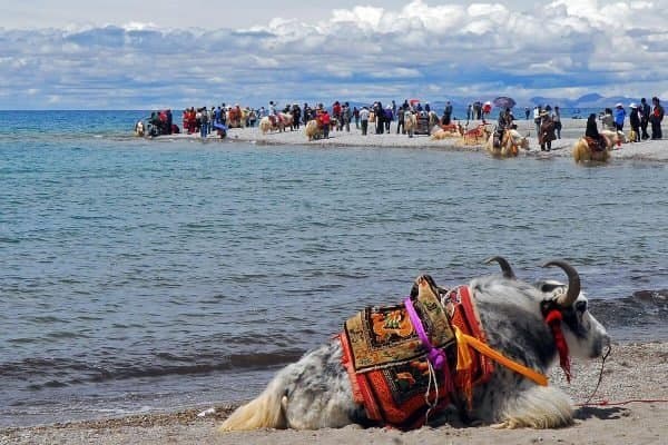
From here, a gradual climb towards the moderate-sized stone-built village of Yari, which has another police post, a government customs office, and a school. Around this nice Yari village, the terraced farmlands yield sufficient crops of millets, barley, amaranth (Marcia), wheat, buckwheat, potatoes, and radishes. After a nice stop here, the walk continues with a climb up this wide valley, then encounters a group of traders, pilgrims, pack animals, sheep, and yaks, and then reaches Sip-Sip, a small settlement of cattle herders with few shops. Our camp is set near a stream at the bottom of Nara Lagna pass.
Max. Elevation:3800 M
Duration:5 Hours
From this camp start the morning walk with a climb leading uphill to a ridge with a huge rock atop Nara Lagna pass at 5,000 m / 15,030ft, the highest spot of this great wonderful journey, from the top offering grand panorama of the Tibetan plateau with Humla Karnali River down below and the green barley fields of Sher or Sera and distance views of snow-capped peaks of Api and Saiphal, after a pleasant stop atop the pass walk leads downhill on the dusty trail to Humla Karnali River. Then we walked along the river towards our overnight stop at Hilsa village, a border and a frontier post with few tents and stone houses surrounded by barley fields. Just across the bridge near this village, a stone pillar marks the Nepal-Tibet border.
Max. Elevation:3720 M
Duration:6 Hours
Morning, a short, steep hour-long climb to Sher in Tibet, after leaving the Nepal side for the Tibet Frontier with a checkpoint, where our Tibetan counterpart guides and driver will meet for an interesting drive to Taklakot, also known as Purang in Tibetan.
Taklakot is an important market for Tibetans, Nepalis, and traders from the bordering Indian region, with separate bazaar areas. During the summer months, the important wool trade continues between the local, nomadic Drogpa herdsmen and Nepali traders, who overnight in guesthouses.
Max. Elevation:3770 M
Duration:4 Hours
After being in the Tibetan side with a different environment with people, towns, and way of living, from Taklakot, a scenic and short drive to Lake Manasarover after leaving Karnali River valley; as the drive continues with gaining heights then reaching the flat area to cross the barren arid, just beneath the magnificent massive Mt. Gurla Mandhata at 7,728 meters, from here it leads to Thalladong pass at 5,050 meters, with stunning views of lake Rakas and holy Mt. Kailash towards the north, after the pass reaching at Chu Gompa near the shore of holy Lake Manasarover for an overnight stop in lodge and guest house or camp (depending upon the season for Indian and Tibetan pilgrims)
Max. Elevation:4510 M
Duration:3 Hours
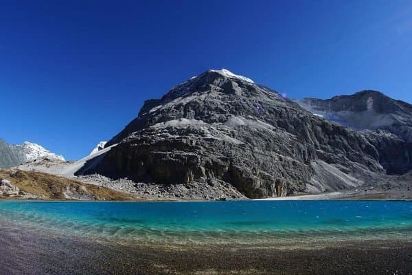
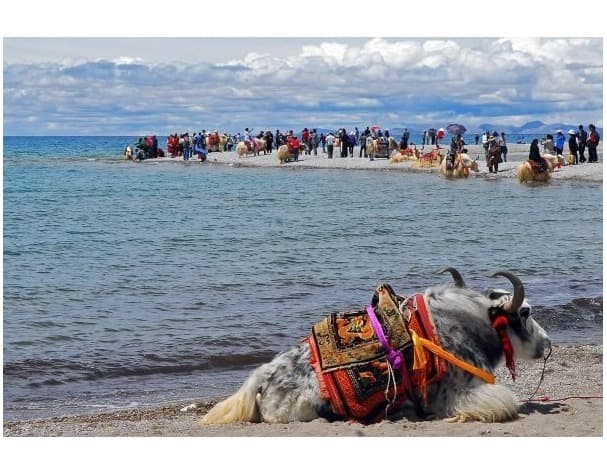
A necessary rest day here at Lake Manasarover which is very important at this high altitude of over 4,000 meters for acclimatization, with an optional short hike to the Chu Gompa, or near the Lake Manasarover which is regarded as sacred by both Hindus and Buddhists and the ancient belief is that a dip in this holy lake will clean the sins of a thousand lifetimes, this large holy turquoise lake located in South West Tibet between Mt. Kailash 6,714 m and Mt. Gurla Mandhata mountain range.
Max. Elevation:4510 M
After a rest day, the morning starts with a short drive to the Barkha windswept valley near Darchen, a busy town with a bazaar. During the auspicious time, this place is flooded with Tibetan and Indian pilgrims for kora, parikrama, or holy circuit walks.
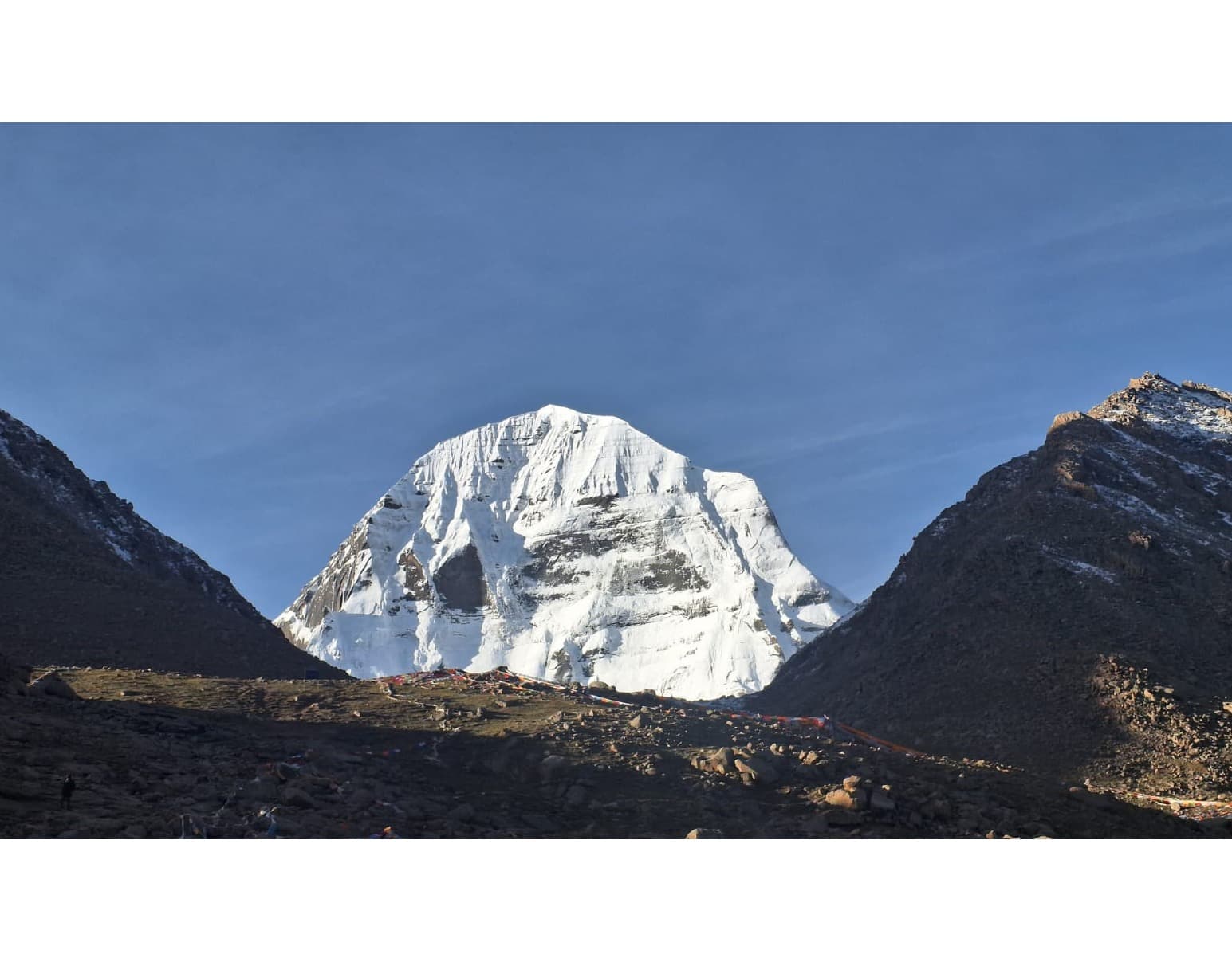
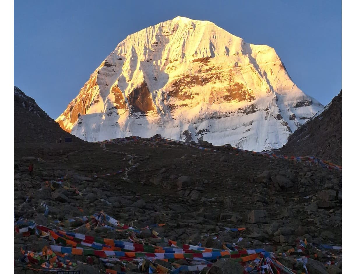
Our journey continues further from Darchen town to Tarboche, one of the holy spots of this region with views of the West Face of Mt. Kailash, from here our holy walk begins leading north on the wide arid terrain to Shershong, and with a gradual climb and pleasant walk reaches to our overnight stop at Dhiraphuk Gompa, with magnificent view of holy Mt. Kailash North Face. Here, depending on the season, pilgrims crowd into guest houses, tents, or our camp.
Max. Elevation:5010 M
Duration:5 Hours
From Dhiraphuk with the highest camping of this trip, the morning walk continues on the uphill trail onto the moraine for more than two hours, then with a steep climb at Dromo-la at 5,630m /18,525ft the highest point of this awesome journey, a big boulder represents the goddess Dolma or Dromo (Tara) festooned with thousands of prayer flags and ritual offering by both Hindu’s and Buddhist pilgrims. This holy spot is a physical and spiritual high point for the pilgrimage or kora. After a nice break, this walk descends into a wide valley and a flat area. After reaching the bottom of Dromo-la pass, the walk is pleasant, and you arrive at Zutul-Puk Gompa for the overnight stop. Zuthul means 'cave' in Tibetan. This place is named after a holy cave where the poet and saint Milarepa meditated in the early 11th century; his footprints can be seen on the cave's rooftop.
Max. Elevation:4790 M
Duration:6 Hours
Today is the last day of this holy circuit and kora, morning walk leads to a nice gradual walk for a few hours on the winding trail, reaching a narrow valley Gorge, from here our walking route turns west towards Darchen, just before Darchen ending this holy trek for a drive towards near Mayum-la pass base for overnight camping, around this area chances of spotting some wildlife and the beautiful Kang a wild ass can be seen herds around this place.
Max. Elevation:5050 M
Duration:5 Hours
Morning drive over the high Mayum-la pass at 5,050 meters, then reaching the other side of the valley with interesting drive and parallel snow-capped mountains views that border Nepal and Tibet, this long scenic drive reaches Saga town for overnight stop, probably in the comfort of nice guesthouses and hotels after passing couple of towns like Paryang, Saga town a growing place with more building construction, this town which is situated on the bank of great river Yamdrok Tsho or Bhramaputra River.
Max. Elevation:4500 M
Duration:6 Hours
From Saga onwards, it gets closer to the Nepal border, as it leads just on the other side of the snow-capped mountains in Tibet that straddle the border with Nepal. An interesting drive today, with a panorama of snow-clad mountains in the vast valley overlooking great views of the Langtang mountains, including Mt. Shishapangma.The drive leads towards the high pass of Laylung-la at 5,050 meters with an awesome panorama of the high central Himalayan range of mountains from Langtang, Dorji Lakpa, Shishapangma, Gaurishanker to Numbur, all these mountains border Nepal, from here the drive descends along with the altitude passing through interesting countryside, villages and farm fields then finally reaching at a moderate size town at Nyalam for the last overnight stop in Tibet. Nylam is the starting and ending point of the large Tibetan Plateau; from here onward to the Nepal border, lush vegetation and pristine, dense forests of rhododendrons, oaks, and pine trees stretch as far as the eye can see.
Max. Elevation:3560 M
Duration:5 Hours
Today is the last day in Tibet, our morning drive leads downhill on the winding road coming across green vegetation and a dense forest of pines -rhododendron and oak tree lines, the road narrows into a river gorge looking at several beautiful waterfalls cascading from high steep rocky cliff shelves, drive follows Bhoti Koshi River most of the way towards Nepal side, then reaching at Zhangmu the frontier and border town here on completing passport- visa formalities, farewell to Tibetan staff driver and guide then heading back to Kathmandu with a nice and pleasant scenic drive to Kathmandu after a great drive reaching at Kathmandu and then transfer back to respective hotels, after a long fascinating trip to Far North West of Nepal and Tibet.
Max. Elevation:1360 M
Duration:6 hours
We have reserved this day to relax and enjoy your last day in Kathmandu with another sightseeing tour in and around Kathmandu, visiting places of interest and importance, or book the Everest/Mountain Flight with us.
Max. Elevation:1300 M
Duration:4 Hours
Last day in Nepal with a wonderful, memorable time in Humla & Mt. Kailash, Tibet with Team Himalaya, and transfer to the airport for the flight back home or to the respective destination.
If the provided schedule isn't suitable for you, we can create personalized travel arrangements.
We had a very successful EBC trek in October 2024 because of Team Himalaya! Our guide, Raj, was very knowledgeable in all things Everest. He set us up in the best lodges where we had great service all along. He provided us with a superb porter, who also went above and beyond in taking care of us. Raj was very patient with us and was always looking out for our best interests. We would highly recommend Team Himalaya for any trek!
AAlec S1st Apr, 2024
Everest Base Camp Team Himalaya March 2024
We have just returned from a 14 day, 11 day hike with Raj and Durga from Team Himalaya to Everest Base Camp. From the minute we landed to our departure we were properly looked after and cared for by Team Himalaya. The trek to and from Everest Base Camp was wonderful, our guides and porters really looked after us and were incredibly knowledgeable. In Nepal things can go wrong especially with flights to and from Lukla but Team responded magnificently and found alternative solutions. If this is on your bucket list as ours and you are looking for a company to organise this with I would 100% recommend Raj.
JJourney379926937861st Apr, 2024
Reaching Everest Base Camp with TEAM HIMALAYA
If you are looking for an adventure of a lifetime, don’t hesitate! Choose TEAM HIMALAYA for your Everest Base Camp trek! We completed the EBC trek early November 2023 . My husband and I chose to do a private trek with Team Himalaya. Everything went smoothly with our guide Raj. His team and organization is outstanding! We could not have done it without him. Raj took care of everything throughout the trek and made sure we were well at all times, even providing us fresh fruits every night after dinner! We felt safe at all times , his experience and knowledge of the Himalayas helped us achieve our goal in reaching the EBC! His professionalism went beyond our expectations from our first contact with him for information until the very end. We will forever remember this expedition and gained a friend in our guide Raj!
eevanhH6577DL13th May, 2023
Incredible Experience by evan
It was an incredible experience being surrounded by the towering Annapurna Himalayas. This memorable trek through Nepal offered the best scenic views and stunning landscapes. Despite being surprised at how quickly the trek ended, the daily walks were filled with dramatic views that left a lasting impression.
I highly recommend this adventure, as it is one of the best base camp treks in the Himalayas with minimal risk of altitude sickness. Although there were steep ups and downs that were tiring on some days, the breathtaking views made it all worth it. This was easily the most exciting trek I have ever experienced.
I want to thank Team Himalayas and Raj for providing exceptional service with their expert guide and staff.