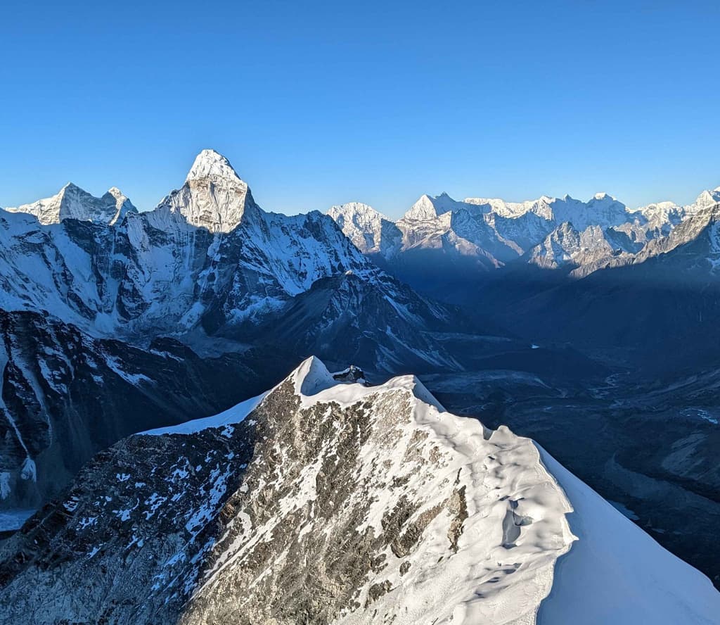
When talking about the monsoon treks in Nepal from June through September, the common picture painted by most is that of endless showers, slippery trails, poor visibility, and a plague of leeches. This applies to about 80% of the country. The clouds formed in the Indian Ocean move northwards towards the Himalayan ranges, releasing heavy rains on routes such as Everest Base Camp and Annapurna foothills.
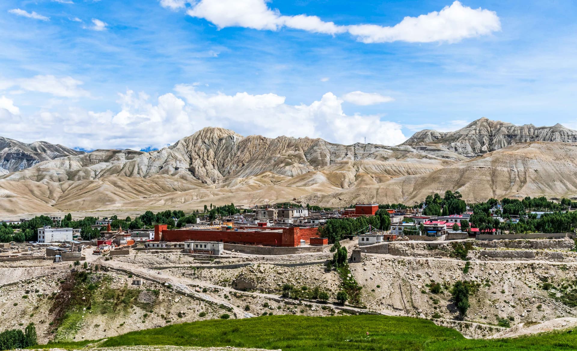
North of the mighty 8,000-meter-high mountains is the Trans-Himalayan Plateau, where there are no monsoon clouds due to physical obstruction by the peaks. In other words, the region receives no rain and remains dry, sunny, and highly colourful throughout the season.
If you wish to undertake monsoon trekking in Nepal without the crowds, showers, and poor visibility, the following rain shadow treks offer an excellent opportunity.
The Top 3 Monsoon Rain-Shadow Routes
Upper Mustang Trek: The Forbidden Kingdom
The trek to Upper Mustang is considered the epitome of rain-shadow treks. Trekking in this area will give you the impression that you are no longer in Nepal but rather walking amidst the barren land of Tibet. Your journey through Upper Mustang will take you past breathtaking red-rock canyons, caves, and the medieval fortress city of Lo Manthang.
Landscape: Desert highlands with vivid rock formations, dramatic cliffs and stark white villages juxtaposed by vibrant green fields of buckwheat.
Monsoon Factor: Completely dry trail. Since the skies are clear, morning flights from Pokhara to Jomsom have a much lower delay rate compared to other mountain flights.
Permits: Under the 2026 permit policies, the inflexible, fixed-fee permit policy has been discontinued and replaced with a variable Restricted Area Permit (RAP) at $50 USD per day. An Annapurna Conservation Area Permit (ACAP) for 3,000 NPR (~$23 USD) is also required.
Day-by-Day Detailed Itinerary
This itinerary for Upper Mustang, which spans 14 days, has been very carefully prepared so that not only do you get enough time to acclimatise yourself, but also to see all those aspects of Upper Mustang that cannot be easily found. The itinerary has been prepared with the understanding that a motorable road runs alongside the traditional route.
Day 1: Kathmandu to Pokhara: Travelling Day (820m)
Fly in 25 minutes from Kathmandu to Pokhara over the Himalayas following the northern wall. Otherwise, ride a tourist bus for 7 hours down along the banks of the Trishuli River. In Pokhara, spend leisure time at Lakeside and organise equipment for restricted areas.
Day 2: Fly to Jomsom & Trek to Kagbeni: 3-4 hours walk (2,810m).
Fly in the morning to Jomsom from Pokhara (flight time – 15-20 min.) over the world's deepest gorge between the Annapurna and Dhaulagiri ranges. Get acquainted with your guides in Jomsom and walk for 3 hours along the flat, windy trail through the Kali Gandaki riverbed to Kagbeni, which is considered the medieval entrance to the Upper Mustang valley.
Day 3: Kagbeni to Chele: 5-6 hours walk (3,050m).
Obtain your Restricted Area Permits (RAP) at the Kagbeni control post. Follow the eastern banks of the river going upstream. Go through the amazing whitewashed Tangbe village with its buckwheat fields and orchards. Then cross a river via a suspension bridge and climb up the rocky slope to arrive at the cliff-side village called Chele.
Day 4: Chele to Syangboche: 6-7 hours walk (3,800m).
Today's route includes crossing two Alpine passes: Taklam La (3,624m) and Darjori La (3,735m). See breathtaking views of Tilicho Peak and Yakawa Kang. After briefly visiting the Samar village and going into the canyon, you climb up and arrive at the small village of Syangboche.
Day 5: Syangboche to Ghemi: 5-6 hours walk (3,520m).
Go through the Yamda La pass (3,850m), climbing the rocky trail and passing through the old teahouses, ancient chortens, and unique Tibetan-style villages. Further climb and go up the Nyi La pass (4,010m) – this is the maximum elevation of the first part of the trek. Then descend into the vast, lush green valley of Ghemi, the third-largest village in the Mustang district, with huge farm fields.
Day 6: Ghemi to Tsarang (Charang): 4-5 hours walk (3,560m).
Cross the Ghemi Khola river and start trekking next to the longest Mani wall in Nepal – a chain of sacred stones carved by prayers stretched for hundreds of meters. Go through the Tsarang-La pass (3,870m) to reach Tsarang village, set before an enormous canyon with the magnificent five-story white fortress, a Dzong, and a red monastery.
Day 7: Tsarang to Lo Manthang: 4-5 hours walk (3,840m).
Get out of Tsarang, cross a mountain stream and climb up to Lo La pass (3,950m). On reaching the pass's crest, the legendary, white-washed, walled city of Lo Manthang opens right in front of you. Arrive at Lo Manthang and check into the teahouse where you will spend two nights.
Day 8: Lo Manthang: Rest and Exploring the City: no packing (3,840m).
Rest and sightseeing day. Walk along the narrow alleys of the walled capital city and visit the three most important 15th-century monasteries of Lo Manthang: Jhampa Lakhang, Thupchen Gompa and Chhoede Gompa. Optional visit – rent a horse or arrange a local jeep tour to Chhoser to see the multi-story Jhong Sky Caves, carved into the rock cliffs many years ago.
Day 9: Lo Manthang to Dhakmar via Lo Gekar: 6-7 hours walk (3,820m).
Start your alternate return trek to visit new scenery. Walk southwest towards Dhakmar, stopping at the incredible Ghar Gompa (Lo Gekar). This temple was built in the 8th century by Guru Rinpoche and nowadays is regarded as one of the oldest temples of Tibetan Buddhism in the world. Arrive at Dhakmar – a village known for its red clay cliffs.
Day 10: Dhakmar to Ghiling: 5-6 hours walk (3,806m).
Leave early to avoid strong winds blowing through the valley in the afternoon. Descend the trail down the eroding yellow and red canyons and pass through farming settlements and the desert areas, arriving at Ghiling village.
Day 11: Ghiling to Chhuksang: 5-6 hours walk (2,900m).
Return to the main valley and continue south, descending significantly from the extremely high-altitude zones. The route changes from the trans-Himalayan plateau to a rocky riverbed trail until reaching Chhuksang.
Day 12: Chhuksang to Jomsom: 6-7 hours walk (2,720m).
Your last full trekking day is coming. Leave the restricted areas region and check out your special permits at the Kagbeni post. Go down the flat 3-hour trail along the windy Kali Gandaki riverbed, arriving in Jomsom.
Day 13: Jomsom to Pokhara to Kathmandu: Travelling Day (1,400m).
Take an early-morning flight back to Pokhara, as winds increase in the afternoon. Take a direct onward flight, drive, or take a bus to Kathmandu.
Day 14: Final Departure: End of Your Trip
Transfer to Tribhuvan International Airport (TIA) and leave Nepal for good.
Upper Dolpo Trek: The Untouched Wilderness
While Upper Mustang may be a cultural journey through time, Upper Dolpo provides a journey into untamed wilderness. Made famous by Peter Matthiessen in his acclaimed novel The Snow Leopard, Dolpo is arguably one of the remotest and least densely populated areas on Earth.
Landscape: Profound canyons, harsh ridges without snow coverage, and stunning turquoise lakes such as Phoksundo Lake (Nepal's deepest lake).
Monsoon Benefit: This high-altitude location receives warmth from the summer sun, providing access to passes such as Kang La Pass (5,360m), which is often snow-covered in spring and fall.
RAP Cost: Dolpo is a strictly controlled region. It costs $500 USD per tourist in the first 10 days, then $50 USD per additional day.
Detailed Itinerary - By Day
Upper Dolpo Trek can be considered Nepal’s best wild trekking destination. Unlike most popular trekking routes, Upper Dolpo remains untouched and is an ideal camping route that passes through remote Tibetan valley systems, crosses high-altitude passes above 5000 meters, and visits Shey Gompa in the foothills of the holy Crystal Mountain.
Due to the great distance of this trekking route and the rigorous need for altitude acclimatisation, the ideal route for the Upper Dolpo trek is the 24-day Upper Dolpo Circuit Route.
Day 1: Arrival in Kathmandu, 1,400m
Arrival at Tribhuvan International Airport. Receive assistance from our representative of your trekking agency. Transfer to your hotel.
Day 2: Permit Collection and Gear Check-Up – Preparation Day
During the permit process of your Upper and Lower Dolpo Restricted Area Permit at the Department of Immigration, meet your guide to make the final check on your extreme camping gear.
Day 3: Domestic Flight to Nepalgunj, 1-hour flight (150m)
In the afternoon, fly to Nepalgunj. Located in the hot, tropical lowlands of southwestern Nepal, close to the Indian border, this is the endpoint of your flight to Nepal's mountain regions. Get an early night's sleep to be fresh for your flight up the mountains tomorrow.
Day 4: Mountain Flight to Juphal, Trek to Chhepka, 35-minute flight / 6-hour walk (2,838m)
This morning, board the spectacular mountain flight up to the small airstrip in Juphal. Gather your group of porters/camping team, then begin the trek down past the district headquarters, Dunai, and into the Shey Phoksundo National Park gates, to the Suli Gad river, then head north towards Chhepka.
Day 5: Chhepka to Amchi Hospital, 6-7 hour walk (3,170m)
Follow the winding track that runs through the thick cedar and pine forests that hug the riverbank. Camp at the Amchi Hospital site tonight. The Amchi Hospital is a unique traditional Tibetan medical facility for the local community of the Dolpo Valley.
Day 6: Amchi Hospital to Ringmo (Phoksundo Lake), 5-hour walk (3,660m)
As you trek through the birch forest, take in the spectacular sight of the waterfall, one of Nepal's highest (200m). After some steep descent, walking through the birch forest, reach the traditional mud-plastered Bon settlement of Ringmo. Ringmo sits right next to the shimmering deep-blue waters of the Phoksundo Lake.
Day 7: Ringmo - Rest Day (Acclimatisation), 3,660m
An important acclimatisation day to help your body adapt to the thinner air. On this day, you could spend time visiting some of the Bon monasteries in the vicinity of Ringmo, talking to the locals who maintain their traditions as followers of the Bon religion, or just relaxing by the lake.
Day 8: Phoksundo Lake to Chunemba, 5-6 hours walk (3,640m)
After an easy trek through the birch forest to leave the beautiful lake behind, you enter a broad valley floor. Follow the wide riverbed trail until reaching the campsite at Chunemba.
Day 9: Chunemba to Snowfield Camp (Kang La Phedi), 6-7 hours walk (4,400m)
Follow the spectacular cliff trail that clings to the shores of Phoksundo Lake. Known as "the most dangerous place in the world" due to its appearance in the Oscar-nominated film Himalaya by Eric Valli. Climb out of the tree line, passing by the stunning cliffs into an open valley surrounded by peaks and rock towers.
Day 10: Cross Kang La Pass to Shey Gompa, 7-8 hours walk (4,160m with 5,375m Pass)
Very early in the morning, start the climb up the shale slope to cross the 5,375m Kang La Pass. You'll enjoy spectacular views of the Tibetan Plateau and Crystal Mountain while making a quick visit to the sacred summit cairns. A steep descent brings you to the mythical 11th-century Shey Gompa.
Day 11: Shey Gompa – Rest Day, 4,160m
A rest day at the heart of the upper Dolpo region, "the Crystal Monastery," a place that many pilgrims visit on their Kora walk around Crystal Mountain. Explore the monasteries on the way to the Tsakang Gompa, a meditative hermitage perched dangerously on the edge of a red cliff above the monastery.
Day 12: Shey Gompa to Namgong Gompa, 6-7 hours walk (4,360m with 4,975m Pass)
Ascend up Shey La Pass (4,975m) for breathtaking views of Mustang to the east and the high mountains of Tibet to the north. Descend into the isolated Namgong Valley to see the ancient Bon monastery of Namgong Gompa, located high above the valley in the steep, rocky walls of a cliff face.
Day 13: Namgong Gompa to Saldang, 4-5 hours walk (4,060m)
A less strenuous trek down to Saldang, an important settlement in Upper Dolpo. The wide, terraced valley holds whitewashed stone houses of prosperous farmers.
Day 14: Day Hike to Yangze Gompa, 5-6 hours, 4,960m
A day excursion further north, where you'll discover Yangze Gompa, an extremely old Bon monastery built in one of the remotest valleys bordering Tibet. Back to Saldang for an overnight camp.
Day 15: Saldang to Sibu, 6 hours walk (4,200m)
Walk further south in the Tarap Valley along the riverbed, enjoying views of yak caravans bringing their goods down from Tibet. Passing by the local monasteries, reach the small settlement of Sibu.
Day 16: Sibu to Jeng La Phedi, 5-6 hours walk (4,370m)
After an easy walk upriver, begin the ascent through the high pastures of Jeng La Phedi. At high altitudes, there is a good chance of spotting the elusive Himalayan blue sheep (bharal).
Day 17: Crossing Jeng La Pass to Tokyu Village, 6-7 hours walk (4,200m with 5,150m Pass)
After reaching the summit of Jeng La Pass (5,150m), see the magnificent views of the huge north face of Mount Dhaulagiri (8,167m). After a steep descent into a wide valley floor, stop for today at the tiny settlement of Tokyu.
Day 18: Tokyu to Dho Tarap, 3-4 hours walk (3,940m)
A shorter but more scenic trek leads into the Tarap Valley to the famous, highest permanently inhabited settlement, Dho Tarap.
Day 19: Dho Tarap – Cultural Rest Day, 3,940m
Visit the monasteries of Dho Tarap, where the population is equally split between followers of Bon and Tibetan Buddhism. Dho Tarap is noted for its unique clothing traditions and turquoise jewellery.
Day 20: Dho Tarap to Sisaul (Tarap Khola), 6-7 hours walk (3,750m)
The long trek back down to lower altitudes through spectacular scenery. Descend into a narrow valley squeezed between steep cliffs to the Tarap River, where you need to cross some impressive wooden bridges built across raging streams.
Day 21: Sisaul to Laina Odar, 5-6 hours walk (3,370m)
Follow the Tarap River as it continues cutting through rock faces to squeeze the landscape into narrow slot canyons. From barren, high-altitude terrain, the landscape starts to change again into lush, rhododendron-covered rock shelves with rose bushes.
Day 22: Laina Odar to Tarakot, 5-6 hours walk (2,540m)
Walk across another river and a suspension bridge over the Bheri River, and arrive in the old fort of Tarakot. The village was once a vital toll station on an ancient trading route connecting India with Tibet.
Day 23: Tarakot to Dunai and finally to Juphal, 5-6 hours walk or local jeep (2,475m)
Walk the last section along the Bheri River to Dunai, then trek the last ascent up the hillside into Juphal, the airstrip area. Celebrate the successful end of your expedition with the whole trekking crew.
Day 24: Juphal to Nepalgunj and back to Kathmandu, Domestic Flights Return
Early in the morning, catch the mountain flight to Nepalgunj, then quickly transfer to your flight back to Kathmandu.
Nar Phu Valley Trek: The Lost Valleys of Annapurna
Hidden just north of the famous Annapurna Circuit is the twin village system of Nar and Phu. These are isolated Tibetan-Buddhist communities that remained inaccessible to tourists until 2002.
Landscape: Deep, narrow rock gorges; pure, untouched glaciers; and ancient stone villages populated by traditional yak herders and highland barley farmers.
Monsoon Advantage: Whereas the starting points of Annapurna trek routes are plagued by rain, once you trek over the mountain passes to Nar and Phu, the skies clear up completely.
Permit Requirements: Extremely inexpensive in the off-season period from December to August. At this time, the RAP costs only $75 USD/week, down from the $100 USD/week charged in autumn.
Definitive Itinerary for 10 Days
Nestled right in between two of the biggest treks in the Himalayas – the Annapurna and Manaslu treks – the Nar Phu Valley Trek is a rough and wild adventure of epic proportions. Only opened to foreigners since 2002, this area still lies concealed within a beautiful, rocky pass. In contrast to the Upper Dolpo circuit, where one needs to be fully equipped for a camping trip, the Nar Phu trek has become an offbeat teahouse trek that combines authentic Tibetan culture with comfortable accommodations in simple mountain teahouses.
Day 1: Drive from Kathmandu to Koto via Besisahar:10-11 hour drive (2,600m).
Get an early 4WD jeep from Kathmandu. Travel along the Prithvi Highway until you reach Besisahar, where you switch to a narrow, bumpy road. Follow the roaring Marsyangdi River upwards through several waterfalls and cliffs until you arrive at Koto, a small stone village situated right along the Annapurna Circuit route.
Day 2: Walk from Koto to Meta (Hidden Portal):7-8 hours walking (3,560m).
Complete your registration for the Restricted Area Permit at the police post in Koto. Detour away from the regular Annapurna route and cross a narrow bridge over the Marsyangdi River to get into the deep and rugged gorge of the Phu Khola. Hike through dense pine and bamboo forests until you finally climb the steep hillside to reach the vast, windy plateau of Meta.
Day 3: Walk from Meta to Kyang:5-6 hours walking (3,820m).
Today, enjoy a relatively easy, flat hike through high, dry, Tibetan-like plateaus. Walk through semi-abandoned settlements such as Junam and Chako, used by the Tibetan Khampa warriors during the 1960 war. Spend the night at Kyang, a peaceful and quiet hamlet located on the edge of a cliff overlooking the river valley.
Day 4: Walk from Kyang to Phu Village:5-6 hours walking (4,080m).
Travel along one of the most incredible trails dug through the vertical canyon walls. Enjoy spectacular scenery as you pass through unique, coloured chortens until you reach the ancient, fortified stone gateway known as Phupigyal Kwe. Finally, make it to Phu, a three-clustered stone village that was carved into the barren hillside.
Day 5: Rest Day in Phu Village:5-7 hours walking (4,080m).
This rest day is crucial if you wish to acclimatise properly. Hike all the way up to the 1,000-year-old Tashi Lhakhang Gompa across the valley to enjoy a nice cup of butter tea with the local lamas. For the active hikers, there is another 5-hour hike to the glacier at Himlung Himal Base Camp (4,920m).
Day 6: Walk from Phu to Nar Phedi Monastery:6-7 hours walking (3,490m).
Hike back the same way as on Day 4 until you come to Kyang. Descend all the way down to the riverbed, crossing a high suspension bridge over an eighty-meter-deep canyon gorge. Continue uphill and finally arrive at Nar Phedi, where you will spend a memorable night within the local Buddhist monastery's guest rooms.
Day 7: Walk from Nar Phedi to Nar Village:3-4 hours walking (4,110m).
Another relatively short yet strenuous morning trek will take you to Nar Village, which is slightly larger than Phu. Watch the locals weaving woollen blankets on their primitive looms while admiring green terraced fields with barley and mustard crops.
Day 8: Climb Kang La Pass to Ngawal:8-9 hours walking (3,675m via 5,240m Pass).
Today is the longest, hardest, and most rewarding day of your trip around Nepal. Get up really early in the morning to climb steep, icy and rocky scree switchbacks up to the Kang La Pass (5,240m). The stunning views of Annapurna II, Gangapurna, and Tilicho Peak will be your reward! Descend downhill along a sweeping scree slope to reach Ngawal village.
Day 9: Walk from Ngawal to Manang:3-4 hours walking (3,540m).
Walk down the beautiful Marsyangdi River valley, enjoying gentle slopes and the magnificent view of snow-capped mountains. Pass the medieval village of Braga with its hillside cliff-monastery to arrive at Manang.
Day 10: Drive from Manang to Besisahar and back to Kathmandu:7-8 hours drive (760m).
Ride in a local 4WD jeep along the valley of the Marsyangdi River till you arrive at Besisahar. From there, board your car or microbus for the final drive to Kathmandu.
Monsoon Challenges Explained: The Three Squeeze Points You Must Plan For
Though the rain shadow locations themselves are completely dry and sunny, reaching them involves traversing through the wet, lower areas of Nepal. Here are the three crucial logistics squeeze points you need to plan for when trekking in the Nepalese monsoon season:
Landslides and Closed Roads
The highways between Kathmandu/Pokhara and Besisahar cut through narrow river valleys with a high likelihood of mudslides and road closures.
The Solution: Always leave an extra buffer. Allow at least two to three "buffer days" at the end of your trek after your international departure.
Cancellations on Domestic Flights
Domestic flights to Mustang and Dolpo use visual flight rules. Even if the destination airports are clear, you may still experience delays or cancellations due to poor takeoff visibility at Pokhara or Nepalgunj.
The Solution: If you have the budget for it, charter helicopters can navigate through gaps in the clouds that twin-otter domestic flights cannot. If this is not possible, you should prepare for a rougher journey in 4x4 jeeps.
The Lower Trail "Tax"
Your initial approach to the rain-shadow areas will involve hiking along a wet, humid, and leech-filled trail on the first day or two of your route.
The Solution: Make sure to pack a small spray of insect repellent or saltwater. Hike in breathable, lightweight trail runners for at least the first two days instead of bulky waterproof boots.
Rain Shadow Packing List Essentials
Your packing list should reflect both the wet, humid conditions during your transit days and the extremely hot, dry climate of the rain shadow.
A Waterproof Backpack Cover: Indispensable. Your backpack should be fully waterproof during transit days.
A Travel Umbrella: Ironically enough, a good umbrella might be better protection against the monsoon than any Gore-Tex rain jacket on your approach hike, since umbrellas keep out rain without holding in humidity.
UV Protection: The atmosphere is very thin in rain shadow areas. The midday sun is very strong. Pack a good wide-brimmed hat, polarised sunglasses, and high-SPF sunscreen.
Electrolytes: Trans-Himalayan winds are highly drying. Sweat evaporates faster than normal. Bring electrolyte pills to maintain fluid balance.
Conclusion: Is It Worth Trekking in the Rain Shadow?
Not if you want clear mountain views of snowy Everest or Annapurna!
However, if you want to discover remote Tibetan cultures, explore pristine desert mountainscapes, and enjoy complete silence along trails that are otherwise overcrowded, then a rain shadow trek in July/August is an absolutely unforgettable experience.